
Tustin ZIP Codes and Coverage
Several ZIP codes serve Tustin or its nearby postal context. The table uses the local distinctions in the research and flags where a number is non-geographic or belongs to an unincorporated or neighboring place. A post-office label is not the same as an incorporated city boundary. A ZIP code directory search should preserve the exact address and then check the parcel jurisdiction.
| ZIP code | Areas or use | Postal note | Local caveat |
|---|---|---|---|
| 92780 | Old Town, civic center, central and west established Tustin | Primary Tustin delivery | Postal reach is not a legal boundary |
| 92781 | Tustin post-office boxes | Non-geographic use | Not a neighborhood or resident ZIP |
| 92782 | East and planned Tustin, Tustin Ranch, Legacy, Market Place | Routed under Tustin scheme | Not identical to the city boundary |
| 92705 | North Tustin context | Santa Ana postal designation | North Tustin is unincorporated county |
| 92602 | Nearby Irvine geography | Irvine designation | Check the parcel before calling it Tustin |
ZIP 92781 deserves special care because it does not describe a neighborhood. ZIP 92705 deserves a jurisdiction check because North Tustin's community name and Santa Ana postal label can suggest a City of Tustin address when the parcel is in unincorporated Orange County.
Tustin 92780 and 92782
92780 is the primary central and established western Tustin context in the research. It includes Old Town and the civic center area, but the postal route still does not define every city edge. 92782 is tied to east and planned Tustin contexts, including Tustin Ranch, Tustin Legacy, and the Market Place area. Those labels help orient a search, but each address still needs parcel verification when the record question is ownership, annexation, or city jurisdiction.
Use a ZIP as a first filter in a spreadsheet or request description, not as the final key. A property tax search accepts a specific address or APN. TaxMap works spatially. RecorderWorks requires a party, document number, type, map, or date. The ZIP narrows the geography, then a street address or parcel carries the records search forward.
The research did not locate an official prose polygon that sets the exact 92780 or 92782 street edge, and it did not verify a ZIP split year. That is useful information for a careful search. Keep the ZIP as a postal clue, then name the address, APN, city, and county separately in a request. A ZIP code directory should preserve that uncertainty instead of turning a broad delivery route into a made-up neighborhood boundary.
92781 Is a Tustin PO Box ZIP
92781 is the unusual ZIP in the Tustin ZIP code directory because the research identifies it as a Tustin post-office-box use rather than a geographic neighborhood. A PO-box ZIP can tell you where mail is routed, but it cannot place a household on a street or identify an assessment parcel. Do not draw a resident map from 92781 alone.
For a mail label, use USPS to verify the address. For a property question, use the situs address and APN. For a person question, use the source that directly answers it, such as a personal voter check, court record, historical directory, or business filing. Keeping the postal and legal layers apart prevents a PO-box result from being treated as a physical residence.
Find Tustin Residents by ZIP
A ZIP can narrow a Tustin residents directory workflow, but the researched Orange County portals do not offer a public ZIP-wide resident or property search. The Treasurer searches a chosen property address or APN. The Assessor requires an eight-digit APN. TaxMap browses parcels on a map. The voter lookup authenticates the person supplying the fields, and the full voter file requires an approved purpose. ZIP geography is therefore a sorting step, not the result.
- Verify the complete address and ZIP through the USPS lookup tool.
- Use the address in the Orange County Treasurer search and save the APN.
- Check the parcel and jurisdiction in TaxMap, especially near North Tustin, Irvine, or a city edge.
- Choose RecorderWorks, the personal voter tool, a court route, or a historical collection based on the actual person or property question.
- Once the ZIP narrows to a street, use the Tustin street directory for the address-keyed chain.
The step order matters because a ZIP-wide guess can combine postal neighbors that do not share a city or county record custodian.
Tustin ZIP Search Modes
The local record systems expose different search modes. None is a general ZIP-capable resident directory. The comparison below states what each tool really accepts and returns, so a researcher can choose an appropriate next step without promising a filter the portal does not have.
| Tool | Search key | Useful result | What it does not do |
|---|---|---|---|
| USPS lookup | Complete address | Verifies delivery ZIP | Does not list residents |
| Orange County Treasurer | Address or APN | Tax and parcel navigation | Does not return a ZIP-wide roll |
| Orange County Assessor | Eight-digit APN | Annual assessment context | Suppresses owner names online |
| TaxMap | Address, APN, or map browse | Parcel and adjacency context | Does not show households |
| Voter lookup | Identity fields | One person's status | Is not a public-by-ZIP list |
ZIP Code Tabulation Areas used for statistics are block-based approximations, not the delivery lines used by USPS. A Census statistic can therefore describe a different geography from a postal search, even when both display the same ZIP number.
The Orange County voter-data application is the closest researched address-organized option, but it is not a casual ZIP search. It requires a stated purpose, security explanation, wet signature, payment, and product choice. The application can request specific records with a present or former residence, or a Street Index after review. A countywide history product, customized file, or printed Street Index carries its own fee and handling terms. That is why a ZIP code directory should describe the lawful request channel without implying that a public web screen will return every name in 92780 or 92782.
North Tustin Uses 92705
North Tustin is an unincorporated Orange County community that commonly carries the Santa Ana 92705 postal designation. It is not the incorporated City of Tustin. This is the strongest local example of a community name, mailing label, and jurisdiction diverging. A searcher who needs a city record should check the parcel and boundary before sending a request to Tustin City Hall.
The distinction also matters for historical work. A directory, newspaper, or family note may say Tustin-area while a deed, tax file, or municipal record follows county jurisdiction. Preserve the source's wording and state the legal custodian separately. The postal record is most useful when it makes that uncertainty visible instead of hiding it.
The Tustin department directory helps identify city contacts after the jurisdiction is confirmed.

A city contact list is a routing aid, not proof that a ZIP address lies inside the incorporated city.
Tustin ZIP Boundaries and City Limits
ZIP boundaries are delivery constructs. City limits are legal jurisdiction lines. County record portals may follow parcel or tax geography, while a mailing label follows postal routing. Census ZCTAs are statistical approximations. When the three do not match, the address and APN decide which public office is relevant. A ZIP can point toward a neighborhood, but it cannot settle an annexation, incorporation, or parcel question.
Tustin's broader geography makes the distinction visible. The city borders Santa Ana, Irvine, Orange, and unincorporated county areas, while I-5 divides north and south and SR-55 shapes the western context. The 2020 Census counted North Tustin separately from the incorporated city. Those are geographic facts for orientation, not a substitute for checking the parcel that a record actually names.
- ZIP code
- A postal delivery area used to route mail, not a legal boundary.
- ZIP+4
- An extended delivery code that narrows a postal address beyond the five-digit ZIP.
- PO-box ZIP
- A ZIP used for post-office boxes rather than a mapped residential area.
- Unique ZIP
- A ZIP assigned to a single institution or special delivery use.
- Carrier route
- A smaller delivery path within a postal system, not a public resident roll.
Boundary check. Verify the exact address with USPS, then verify the parcel and jurisdiction with Orange County TaxMap before relying on a ZIP-based conclusion.
Tustin Ranch and Legacy ZIP Context
Tustin Ranch and Tustin Legacy are useful geography clues within the 92782 context, but planned-area labels still do not replace a parcel key. Tustin Legacy also carries a distinct history of base reuse, environmental review, planning, subdivision, and interim road names. A ZIP code directory can identify the broad postal setting; city, county, and federal records explain the land history.
The 1968 centennial renaming adds another layer. D Street became El Camino Real, 4th became Irvine Boulevard, and H became Centennial Way. Search current and former names when a ZIP narrows the place but an older source does not match. Legal descriptions, tract names, and APNs are the bridge across the change.
Verify the ZIP Before Searching
USPS is the right tool for one delivery address. Orange County TaxMap is the right next tool for one parcel. The Tustin ZIP code directory should end with a stated record purpose: delivery verification, parcel location, city jurisdiction, historical geography, or a lawful person lookup. Each purpose has a different source and a different access boundary.
The USPS ZIP lookup interface verifies a complete address before a record search.
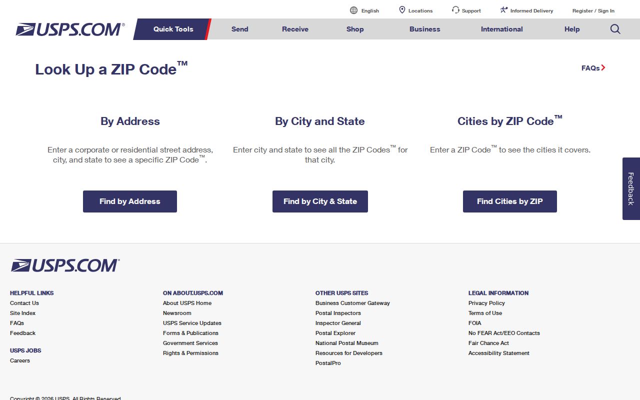
The USPS result answers where mail is routed. It does not answer who lives at the address or which office owns the underlying record.
Keep the verification date with the result because postal and county data can change at different times.
Practical rule. Keep ZIP, city, county, APN, and street name as separate fields in every note so a postal label never silently becomes a legal conclusion.